Brenda Helleberg
Burncoat
High School
Worcester,
MA
Horticulture/
Agriculture
Home
Maps and GIS
Maps:
The study of a geographic area with use of a map can greatly enhance learning
for students. Many classrooms today are without wall maps or globes to
use as visual aids and so having students create maps of the regions to
be studied helps to familiarize them with the regions location in relation
to other places and can help them to gain other important knowledge about
a region's topography, rivers, etc.
GIS:
What is GIS? Essentially it is a computer software, hardware and data
system that lets you " layer" information about a geographic
location. This system lets you visualize, analyze, manipulate and display
data about a location "spatially. Although this technology may not
be available to you in your school computer lab it is a system that your
students can learn about and explore its uses.
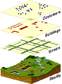
Above a smaple of GIS Layering of Data on a greographical site.
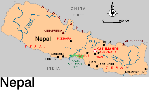
Below a map of Nepal with Mt./River/Site information.
This site was created by Brenda Helleberg at the NEH Summer Institute "Cultures and Religions of the Himalayan Region," held at the College of the Holy Cross, Summer 2004