Lisa Faden
Newton North High School, Newton, MA
Tibet in an Asian Studies Curriculum
Geography
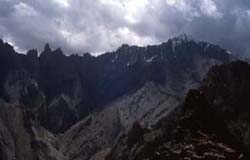
Geography of Tibet
My approach to geography focuses on how people have adapted to the dramatic and often harsh conditions of the Tibetan environment. Before introducing the topic of Tibet to your students, it is important to understand that "Tibet" means different things to different people.
When you look at most maps of Asia, Tibet is marked as the Tibetan Autonomous Region, a region defined and administered by the People's Republic of China. But historically Tibet is better defined as the Tibetan Culture Area, which includes the larger area in which ethnic Tibetans have traditionally lived. This includes the Tibetan Autonomous Region' plus the Chinese provinces of Sichuan, Qinghai, and Gansu, as well as parts of northern Nepal and India.The reality is that the majority of Tibetans live outside of the place that is marked "Tibet" on the modern political map, so when I refer to Tibet, I am talking about the Tibetan Culture Area. For a more detailed description of the borders of cultural Tibet, see the Tibetan & Himalayan Digital Library's Introduction to the Himalayas.
Map Lesson Ideas
The Tibetan & Himalayan Digital Library is my starting point for an introduction to the geography of Tibet. Students will begin with the interactive map of Tibet. They will use the map to answer questions about Tibet's geography. It is important to note the relationships among topography, population density, grain output, and natural resources.
An additional project could be for students to work in groups to make their own maps on posterboard and use them to teach the class. One group could work on a mark of important religious sites; another could indicate different agricultural products; and one could show important trade routes. For more ideas about using maps as a cooperative learning activity see Primary Source's curriculum Mapping China Using Big Maps.
Using the Film Himalaya in the Classroom
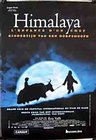 |
The 1999 film Himalaya, directed by Eric Valli, is a very engaging feature film and an amazing opportunity to view traditional life in the mountains of northern Nepal. The film follows an aging chief who must lead a caravan of yaks to lower Nepal to trade Tibetan salt for grain. Although it is not a deocumentary, the film is a very realistic representation of life in the Dolpo region of Tibet because it was made on location with real people (not professional actors) who also participated in the writing of the story. For example, there is a sequence that takes place during a severe winter snowstorm, and the sequence was filmed during an actual snowstorm. |
Himalaya was filmed over the course of 9 months in Dolpo, which is between 4000 and 5500 meters altitude, and is one of the highest places in the world to be inhabited by people. The climate will only grow enough grain to support the population for part of the year. The people of Dolpo support themselves for the rest of the year by gathering rock salt in the mountains and selling it at market. The journey to market is a dangerous one taken by yak caravan. Eric Valli and Debra Kellner made a book about the making of the film, Himalaya: The Making of the Film by Eric Valli (New York: Henry N. Abrams, 2001).
The film presents a chance for students to observe the setting, material
culture, religious practice, and interpersonal relations of Dolpo. If
there is time to watch the whole film, I will ask students to take notes
on the following questions:
1. Describe the physical setting of the film. What do you notice about the land and its physical features?
2. What rituals do the people in the film use to observe the death of a loved one?
3. How do they use divination to make important decisions or provide protection against nature?
4. How are power and authority distributed in the village?
5. Describe how the material culture of the people -- what do they wear? what do they eat? what tools do they use?
6. What kinds of work do you observe them doing? Describe the economics of the village.
If there is only time to watch excerpts from the film, here are some scenes to focus on:
The funeral scene is about 10 minutes into the film. It shows a sky burial, in which the body of the deceased is carried to a high place and offered to vultures. In the Tibetan Buddhist tradition, sky burial represents a final act of generousity on the part of the dead, as their final act is use their body to sustain life. The movie allows students to see the ritual dress, dancing, and drumming on Tibetan two-sided drums. It also shows them chanting from ritual texts, which are printed on long, thin sheets of paper and bound between blocks of wood. (10 minutes)
The next scene shows a meeting of the village elders to decide who will lead the yak caravan. The natural choice is Karma, but Tinle does not want Karma to lead the caravan because he holds Karma responsible for his son's death. Also, Tinle wants to preserve this leadership role for his grandson, who is still too young to lead the caravan. Tinle insists that he will lead the caravan. Tinle then takes his grandson to a blacksmith and has him ceremonially adopted into the blacksmith's family because blacksmiths are low caste. They believe that demons target the fortunate, and by disguising his son as a blacksmith's son he will avoid bad luck. (5 minutes)
The most stunning sequence in the film is the Demon's Path sequence, about one hour into the film, in which Tinle takes the caravan on a perilous shortcut along a very narrow mountain path. The cinematography is at its most stunning here. At one point the path collapses in the lake below, and the caravaners must rebuild it using the small pieces of wood and loose rocks that they have on hand. (10 minutes)
This site was created by Lisa Faden at the NEH Summer Institute "Cultures and Religions of the Himalayan Region," held at the College of the Holy Cross, Summer 2004