Lorena A. Ortiz
Wiregrass Ranch High School
Interdisciplinary Perspectives of the Himalayan Region
|
South Central Asia
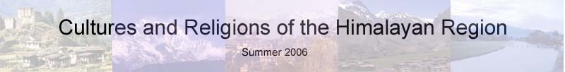
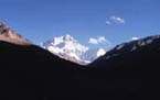
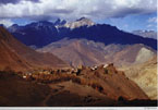
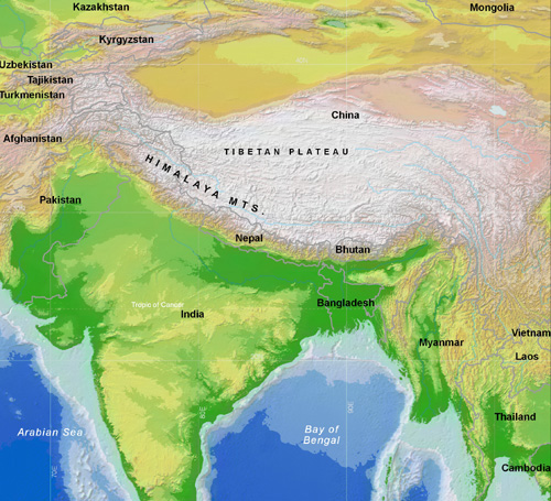
The geography of South Central Asia, particularly in the Himalayan region is diverse and complex physically, politically and culturally. Over fourty million years ago a tetonic collision occured between the indian subcontinent and west Asian continent causing the Himalayan Mountain range and surrounding plateaus. There are over 30 peaks rising more than 25,000 feet including Everest and Kanchenzonga, the tallest and third tallest mountains in the world. The mountains continue to grow an average of one centimeter per year with some peaks rising 10 centimeters per year. There are over 200 glaciers in the Himalaya, it is the only source of water for some as in Tibet. The geography has affected the way of live and belief for the people of this region. Hindus believe that the mountains are gods and all origin derives from them. Ancient civilization began in the Indus Valley near the Ganges, Hindus sacred river and the Indus river over 3,000 B.C.E. Presently, the geopolitics is contested in many places such as Kashmir, Tibet, and Nepal. Historically, the diverse relations between neighboring mountain countries have created the political disagreement. The geography Lesson will actively involve students to create a Big Map of the region, identify and label geographical and political features as well as other important facts. Students must reference the texbook, atlas and internet (if available) to complete the map and GeoPoem activity. |

This site was created by Lorena Ortiz at the NEH Summer Institute "Cultures and Religions of the Himalayan Region," held at the College of the Holy Cross, Summer 2006