
Introduction |
Geography |
History |
Communication |
Beliefs |
Society |
Economy |
Government |
Technology |
Links to Other Websites |
|
|
 |
Geography |
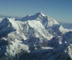
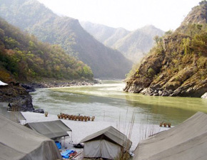
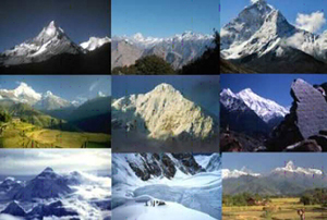
India is a subcontinent which means it is smaller than the size of a usual continent. It is part of the continent of Asia. The geography of India varies widely from snow-capped mountains in the north to tropical lands in the south. There are rivers and wetlands as well as deserts that make up the Indian subcontinent. Three bodies of water and six other countries touch the border of India and another country is nearby.
See how well you can locate these important places in and around the Indian subcontinent. Take a worksheet from the Learning Center and put the number from the map on the line next to the correct name. To check your answers, click here.
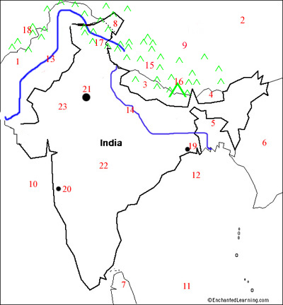 |
_____ Bangladesh _____ Bay of Bengal _____ Bhutan _____ Bombay (Mumbai) _____ Calcutta (Kolkata) _____ China _____ Deccan Plateau |
_____ Ganges River _____ Himalaya Mts. _____ Hindu Kush Mtns. _____ Indian Ocean _____ Indus River _____ Karakoram Mtns. _____ Kashmir* _____ Mt. Everest |
_____ Myanmar _____ Nepal _____ New Delhi _____ Pakistan _____ Sri Lanka _____ Thar Desert _____ Tibet* *is a region of a country |